In this Substack we celebrate the art and craft of Place Writing. Do you want to be inspired? Join our band of readers and writers who love everything about place and home. Subscribe now and get fortnightly posts delivered to your in-box for free.
Tourist Maps
For more than two centuries specialty maps have been produced to satisfy the needs of the tourist. The popularity of guidebooks and tourist maps grew in the 19th century in the light of international discovery, such as that by the British seafarer Captain James Cook. This, along with increasing economic wealth during the Industrial Revolution, lead to an upsurge in leisure travel. With a map to hand, people who had the means to travel, took courage to explore—they knew that when they returned home they could get the map out and tell stories of where they had been and what they had seen. Interestingly, it is said that when Dostoyevsky visited European cities he looked at the guidebook maps and deliberately avoided the recommended tourist sights because he felt obligated to see them; instead, he went to unmapped areas and explored the less admired and less popular byways.
Back then, the map could be proof of a journey. Today, when we flick through our camera roll of images and show our friends the highs (and possibly lows) of a recent holiday, we repeat the ritual of evidencing a journey.
Armchair Travel
Maps in books provide readers with a chance to armchair travel through real and fictional worlds. The mapmaker invites you to skim through white space, sail upon curlicues, speed along parallel lines, dive through symbols, and disappear down gradients of cross-hatching. I think maps enliven any page in a book—they enrich a narrative—and the reader can choose when, or whether, to engage with them.
Maps as Mnemonic Aids
Besides playing a vital role in enhancing the reader experience, authors have long since drawn them as visual and mnemonic aids. On the page, these imaginary landscapes help writers organise topographical features, define boundaries, and track their characters’ whereabouts. When writing The Chronicles of Barsetshire, Anthony Trollope sketched a map to help him plot the story, and eventually it became essential for it to be published: ‘I almost fear that it will become necessary, before this history be completed, to provide a map of Barsetshire for the due explanation of all these localities’ (Moody, 2013). Thomas Hardy was not so reticent, he had an eye on sales for his story, Return of the Native, and was confident that a map would be worthwhile; he sent a drawing to his publisher with the instruction to ‘place an engraving of it as frontispiece to the first volume’ (Hewitt, 2014).
Geography plays an important part in fiction and non-fiction, and can become as influential in the narrative as the characters themselves.
Maps in Contemporary Place Writing
In my recent reading of contemporary books that come under the broad spectrum of Place Writing, I’ve come across some interesting examples:-
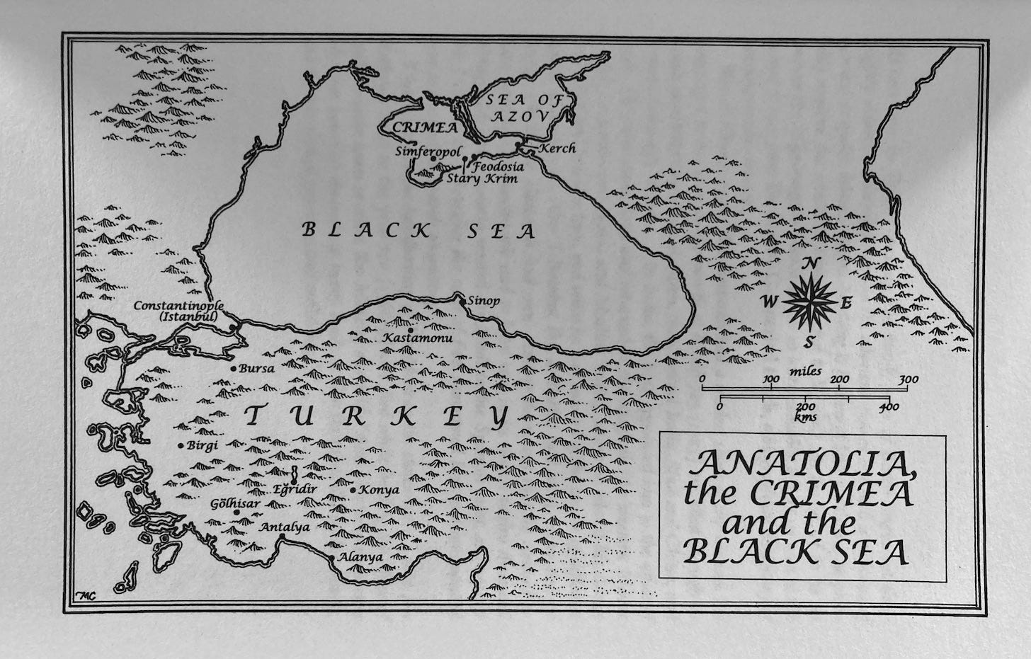
Tim Mackintosh-Smith invited the artist Martin Yeoman to create sketches for his book and several drawings sprinkle through the text of Travels with a Tangerine. Three hand-drawn maps preface the text and, significantly, they set the book in its geographical context, from Egypt to the Black Sea. The book is a complex history of travel and its maps orient the reader.
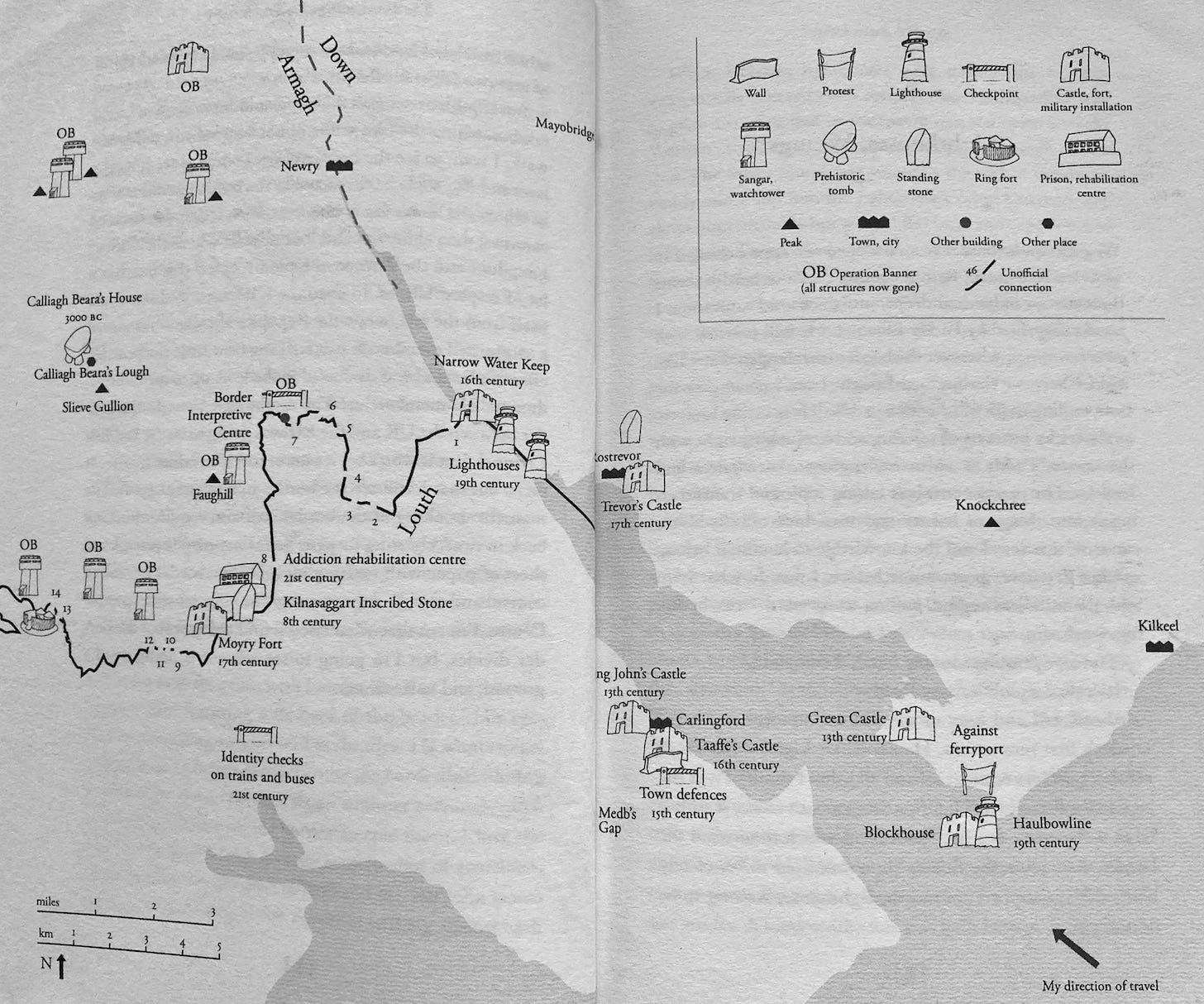
Garrett Carr set himself the challenge of walking along Ireland’s border, a story which he recounts in The Rule of the Land. Carr drew the maps himself; they depict various sections of the route and can be seen in chronological order with the text. The author’s joy in discovering old houses and round towers is palpable.
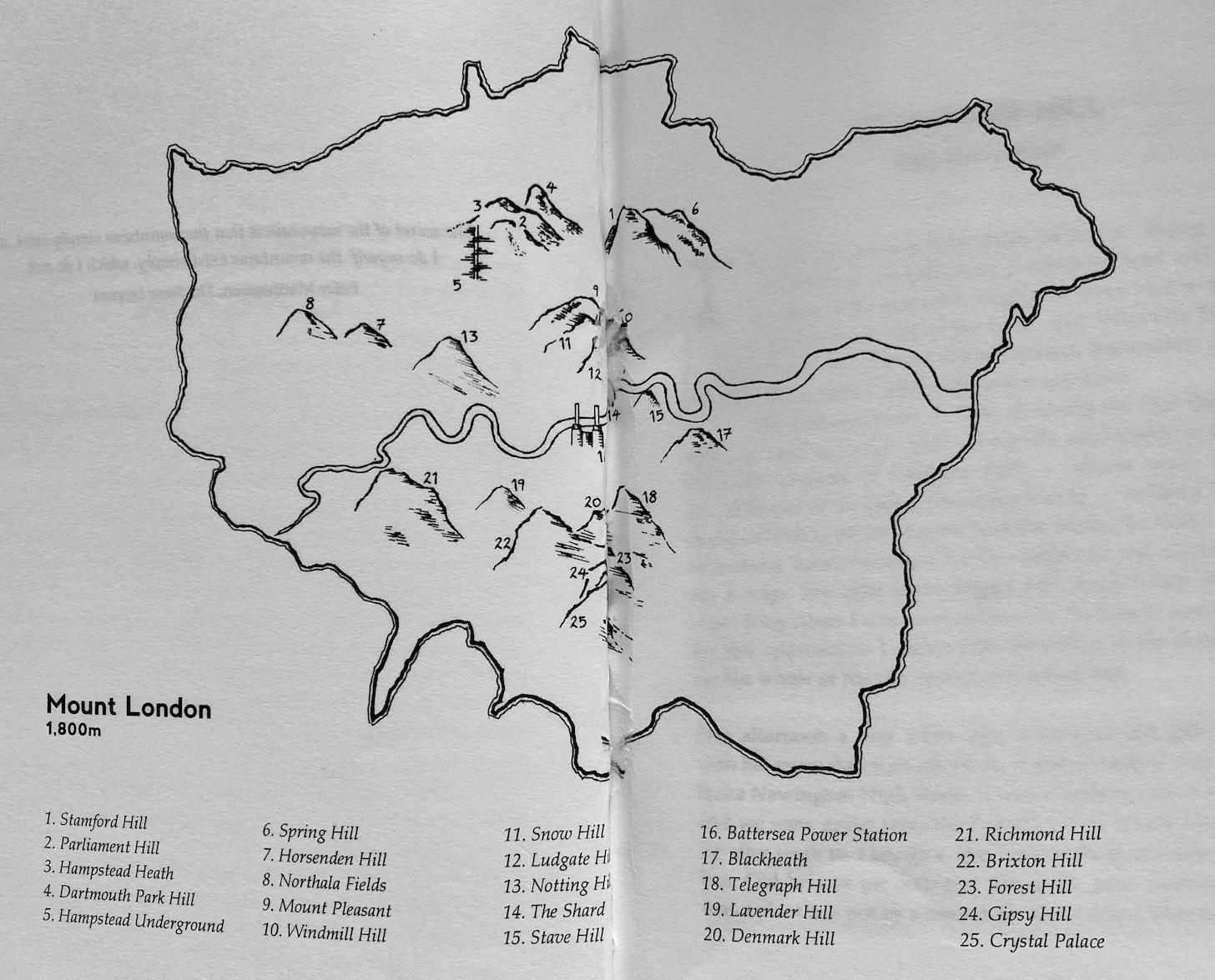
In Mount London a single map prefaces twenty-five stories in the anthology. The information given is sufficient for the reader to appreciate that the locations of the essays are all within Greater London, hence the map acts as a pictorial container. I contacted the editor, Tom Chivers, and asked about the origins of the map. He said that artist Nick Murray, who is Associate Producer of the publishing company, inserted the map as rather an afterthought in the production process. Interestingly, the editors complemented the book by reproducing a Google map on their publicity website where red pins identify the twenty-five locations covered in the text.
Exploring Literary Maps in Real Life
Readers, should they feel inclined, can seek out locations mentioned in a book; if they exist, they can visit them in real life. Those who don’t follow up on foot become vicarious visitors; they develop their relationship to the places in the narrative inside their heads.
Designing Maps for Books
Before including a map there are many design decisions to make. These include size and style of fonts. A large font, for instance, will stand out and possibly be read first while smaller fonts may be missed. In respect to the use of symbols, it may be necessary to include a key to explain their meaning. And when deciding on the amount of detail to be included or excluded, consider how this may affect the map’s perceived veracity. Design is a powerful tool and can manipulate the readers thinking. How ‘truthful’ does the map need to be?
So what can we take away from this short exploration of the literary map?
It is important to establish what function a map within a book serves, only then can decisions be made about its design and parameters. I think they increase the visual appeal of a book, and they’re a useful alternative/additional means of communicating information.
A collaborative project with an artist may be more productive and professional than reliance on an author-generated map and a variety of formats is available—digital, hand-drawn, analogue, online pages, and also app development.
A well-designed map can aid the reader experience and encourage personal interpretation. It’s possible that maps in books encourage readers to make new narratives as they combine visual and textual landscapes.
Maps can generate outdoor pursuit.
A literary map collates information and acts as a graphical summary for the reader.
Depending where the map is located in the text, and indeed how much information it contains, it can arrest the reader for a while as they move their attention from text to map, and from map to text, in order to progress through the narrative (I found this to be so during my reading of The Rule of the Land).
There are many different types of mapping and a myriad number of ways that maps can be utilised, but it is apparent that certain skills are required both of the map maker and the map reader: these include spatial awareness and an ability to interpret information. Some maps are eminently suited for communication via the internet while others work best on paper; the choice of media and form depend on a map’s data and its intended audience.
In conclusion, while it can be argued that hand drawn maps are old technology the same could be said of the printed book, and before the Covid-19 pandemic came about book sales were competing with eBooks in what seemed like a losing battle. There has, however, been a resurgence in interest in books as objects, which comes from over exposure to screens, and a desire for slow reading and slow entertainment. So, I’m convinced we are likely to see more maps in books. What do you think?
Can you recommend any books that contain interesting maps?
Do you like to ‘read’ atlases or map books?
How do you keep tabs on places, and the comings and goings of characters in a complex story?
Credits & Links:
Photos are my own from copies of books I purchased.
Anthony Trollope’s Chronicles of Barsetshire include: The Warden, Barchester Towers, The Small House at Allington, Doctor Thorne, Framley Parsonage and The Last Chronicle of Barset.
Carr, G. (2017) The Rule of the Land. London: Faber & Faber Ltd.
Chivers, T. & Kratz, M. (Eds) (2014) Mount London. London: Penned in the Margins.
Hewitt, A. (2014). The Castaways of Egdon Heath: The Return of the Native as ‘Island Narrative’. The Thomas Hardy Journal. Vol. 30, 2014, pp. 102–120. [Online]
Mackintosh-Smith, T. (2001) Travels with a Tangerine. London: John Murray (Publishers) Ltd.
Moody, E. (2013) ‘Mapping Trollope; or Geographies of Power.’ The Victorian Web. [Online]


Thank you for including my work in this. 'The Writer's Map: An Atlas of Imaginary Lands' edited by Huw Lewis-Jones, has lots of other great examples and some really good essays by writers on how the use maps (real or imagined) in their work. I sometimes use the one by David Mitchell with my students.
Thanks again,
Garrett
Great stuff.
Maps are hugely important in fantasy, and often in SF and historical fiction too.
Ursula K Le Guin said this:
"After I'd gotten over the panic, and a big story about a young wizard began to sketch itself out in my head, the first thing I did was sit down and draw a map. I saw and named Earthsea and all its islands. I knew almost nothing about them, but I knew their names. In the name is the magic."
The Books of Earthsea, Introduction.
I've created a map of my fictional world but haven't shared it yet, except in a post for my email newsletter. I think I'll dig that one out, give it a quick going over, and repost it here.